
File:Boston college town map.png
Size of this preview: 660 × 599 pixels. Other resolutions: 264 × 240 pixels | 529 × 480 pixels | 846 × 768 pixels | 1,127 × 1,024 pixels | 2,213 × 2,010 pixels.
Original file (2,213 × 2,010 pixels, file size: 1.36 MB, MIME type: image/png)
| Description |
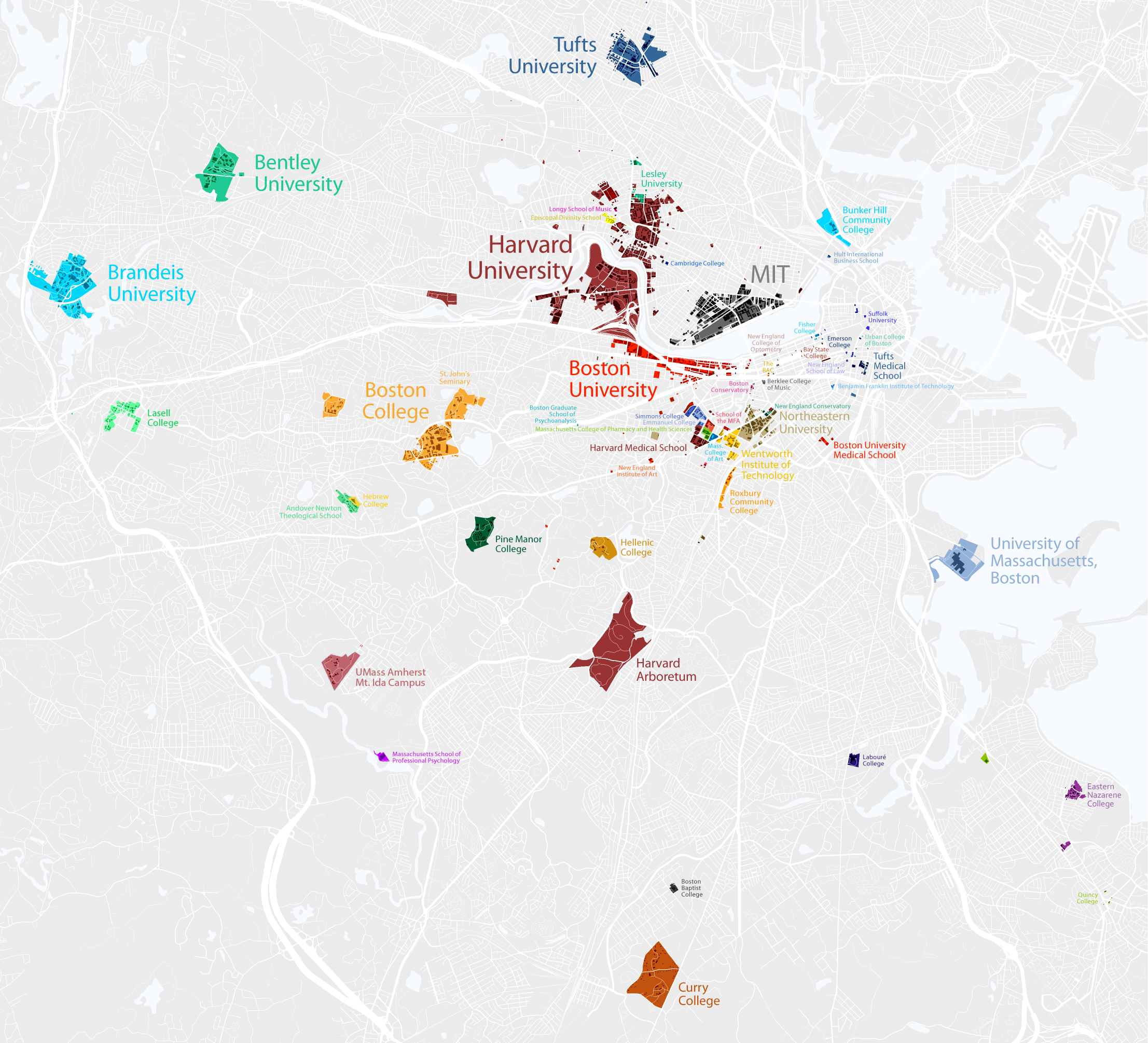
Map of colleges and universities in the Boston, Massachusetts area العربية: خريطة جامعات منطقة بوسطن |
| Date | 2007 |
| Source | http://www.radicalcartography.net/?boston_campus |
| Author | Bill Rankin |
| Permission (Reusing this file) |
|
This file is licensed under the Creative Commons Attribution 2.0 Generic license.
- You are free:
- to share – to copy, distribute and transmit the work
- to remix – to adapt the work
- Under the following conditions:
- attribution – You must give appropriate credit, provide a link to the license, and indicate if changes were made. You may do so in any reasonable manner, but not in any way that suggests the licensor endorses you or your use.
File history
Click on a date/time to view the file as it appeared at that time.
| Date/Time | Thumbnail | Dimensions | User | Comment | |
|---|---|---|---|---|---|
| current | 22:50, 27 October 2021 | | 2,213 × 2,010 (1.36 MB) | wikimediacommons>Simtropolitan | Updated: Wheelock now part of BU (2018); Mt Ida now UMass Amherst Mt Ida Campus (2018); Newbury College closed, now senior housing (2019) |
File usage
The following pages on the English Wikipedia link to this file (pages on other projects are not listed):